Map Interface
A tour of the TrailHUB map screen: the navigation bar menus, the drawers they open, and the map controls.
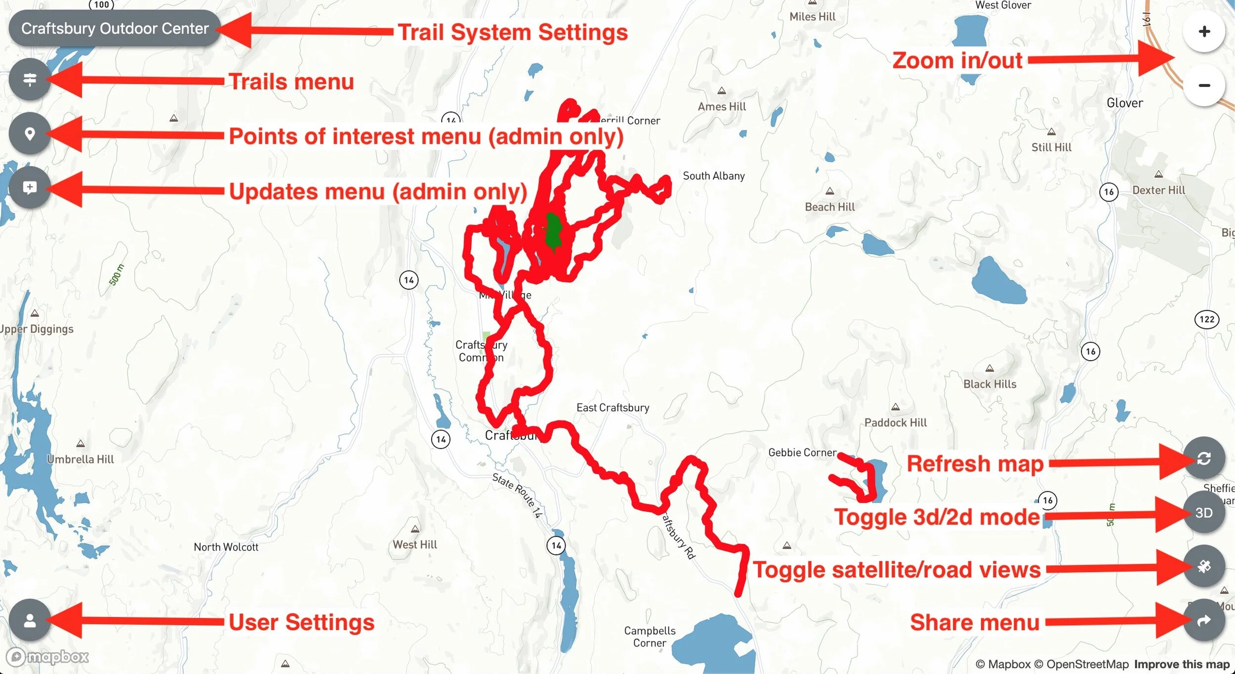
The map interface contains most of what you need to manage your trails. Menus open as panels ("drawers") over the map; close a panel with the X in its corner.
#Navigation bar
Your trail system's icon and name sit at the left. Click them to open Trail System Details. If weather is enabled on your plan, the current temperature appears beside the name and opens the weather panel.
The menu items, left to right:
- Trails - the trail list, search, bulk edit and the Create Trail tool. See Trails.
- Points - points of interest, lifts, webcams and other map features. See Points and map features.
- Updates - notices, surface conditions and snow reports (managers only). See Updates.
- Calendars - appears when calendars are configured on a Double Diamond or Star plan. See Calendars.
- Related trail systems - a drop-down of the systems you have linked, plus a "browse all of TrailHUB" link if you have enabled it. See Related trail systems.
- Share (share icon) - direct link, embed codes, QR code and signage mode. See Sharing.
- User Settings (person icon) - account details, billing, trash, API keys, My Trail Systems, log out. See User Settings.
- Trail System Details (info icon) - stats, description and, for administrators, the Trail System Settings, Trustees and Calendars Settings buttons. See Trail system settings.
- Help (question icon) - opens this documentation.
On phones the same items appear as a scrolling row of tabs along the bottom of the screen.
#Map controls
- Zoom and locate me controls sit in the upper right. While you are creating or editing a trail system, an address search box also appears there.
- Refresh Zoom (circular arrow, lower right) zooms back out to fit all your trails.
- Toggle Satellite/Road (lower right) switches the base map. See Map modes.
- Click any trail line or point marker to open its details.
Trail lines are coloured by status: green for Open, yellow for Caution, red for Closed. Trail names appear along the lines, and point labels appear when you zoom in.