Upload a Trail File
Map a new or existing trail by importing a GPX, KML, KMZ, GeoJSON, or zipped shapefile.
Add a map line to a new or existing trail by importing a file. Supported formats are .gpx, .kml, .kmz, .geojson, and zipped shapefiles (.zip). Only line features are used; if a file contains no lines but does contain points, TrailHUB connects the points into a single line. If you have a file in another format, email support@trailhub.org.
To import a single file containing many trails at once, see Upload one file with many trails.
#Steps
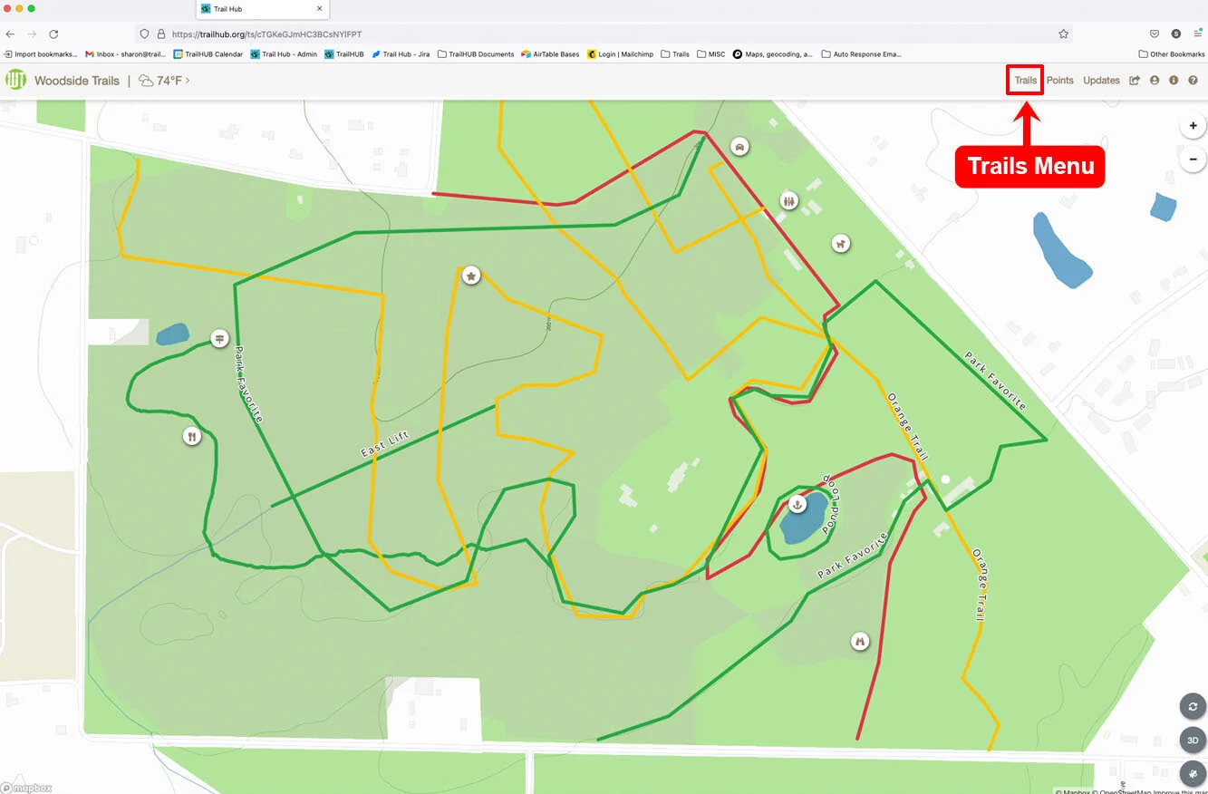
Click Trails in the top navigation bar.
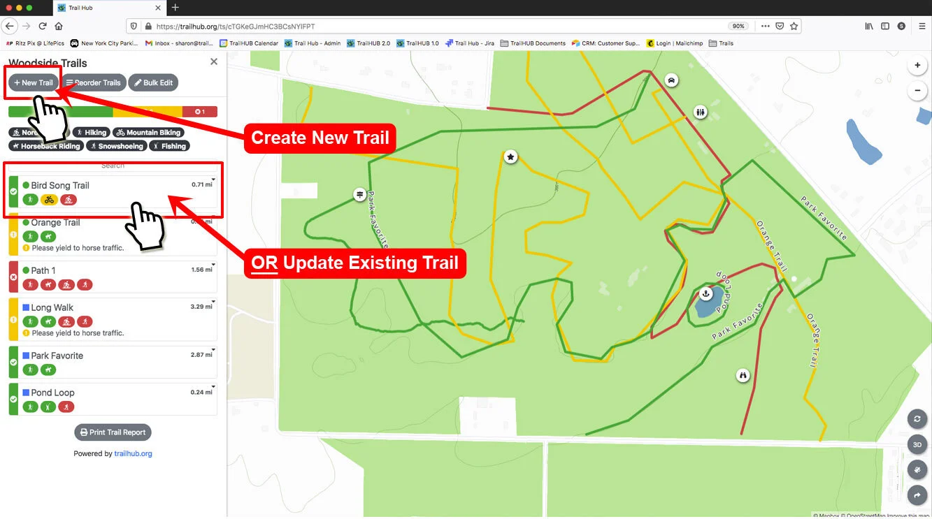
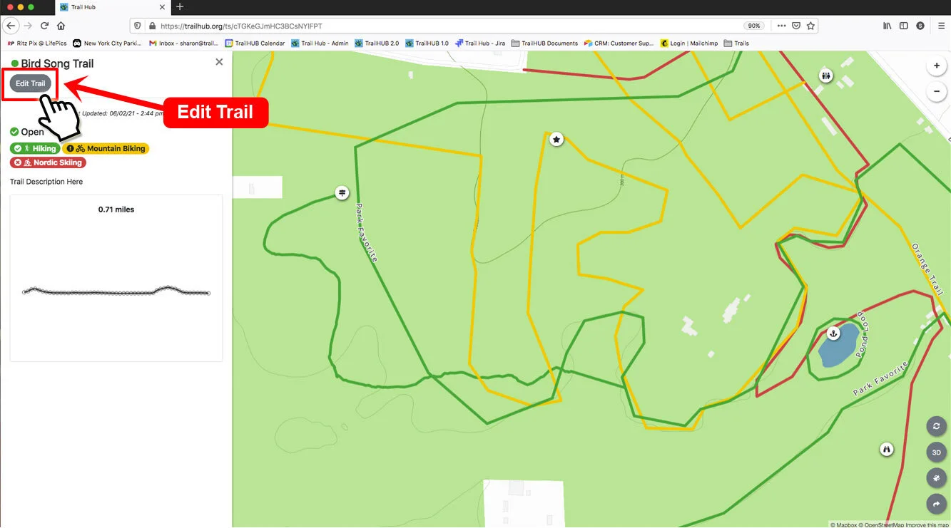
Click an existing trail card and then Edit Trail, or click New Trail. (For new trails, see Create a trail for the remaining fields.)
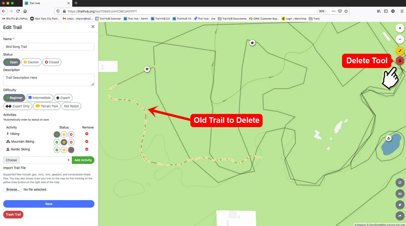
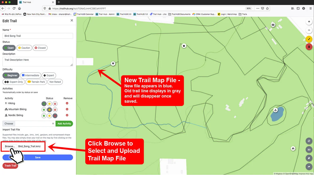
If the trail is already mapped and you want to replace its line, select the existing line on the map and press Delete on your keyboard or click the trash button under the line tool. The old line remains visible in gray until you save.
Under Import Trail File, click Choose File and select the file from your computer. The trail is drawn on the map immediately and the map zooms to it. If nothing appears, email the file to support@trailhub.org and we will troubleshoot it.
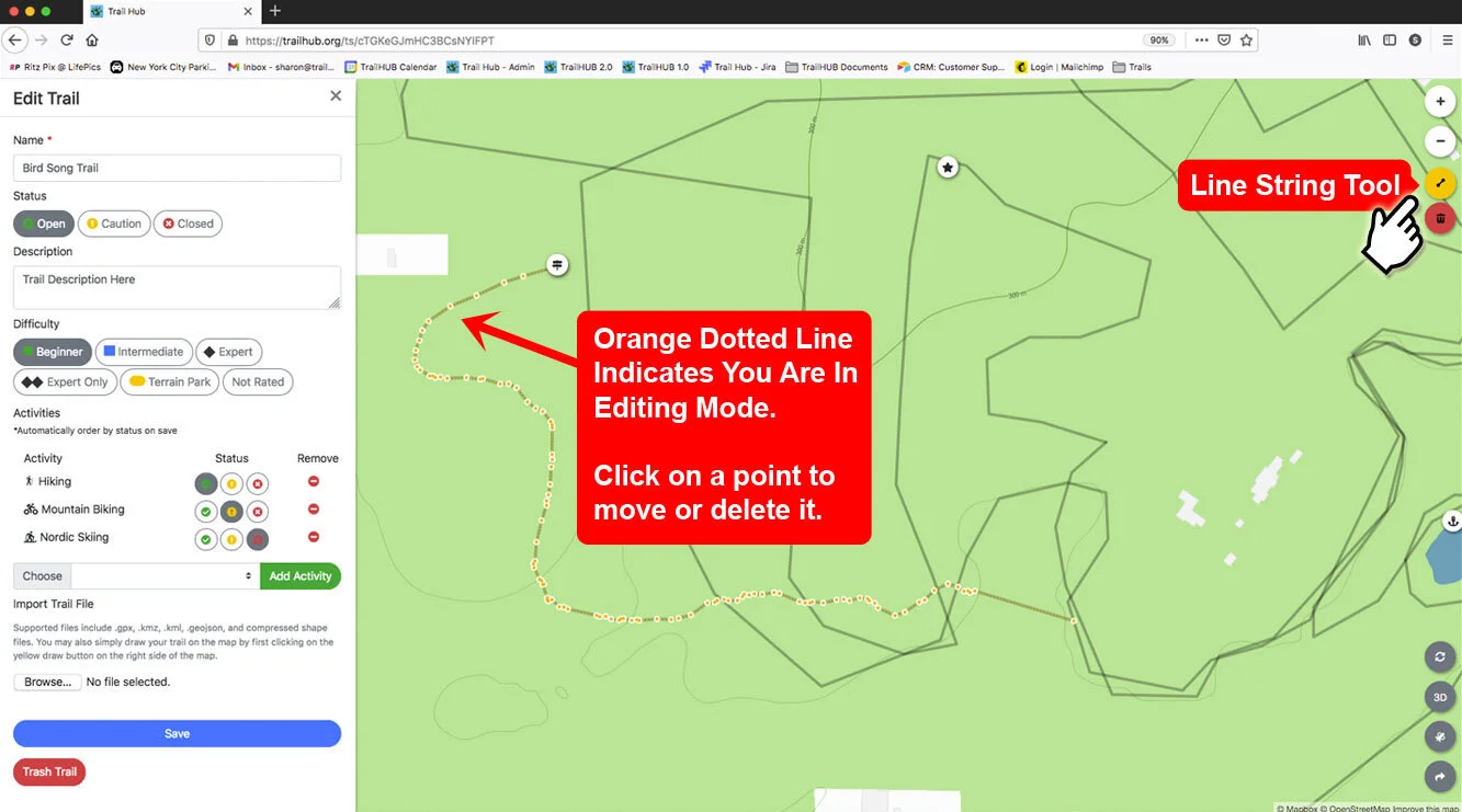
To refine the imported line, click it on the map and adjust its points with the line tool.
Click Save.
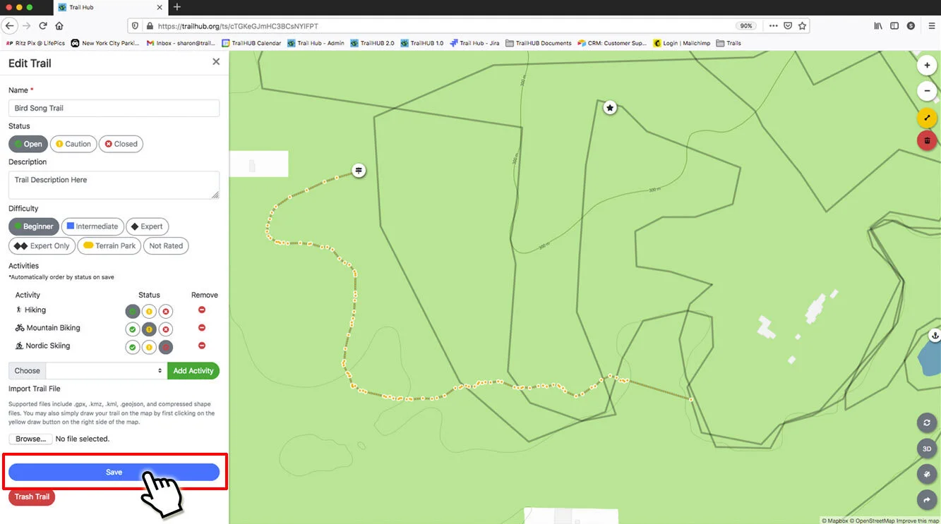
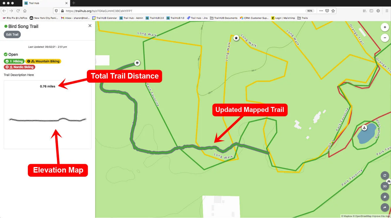
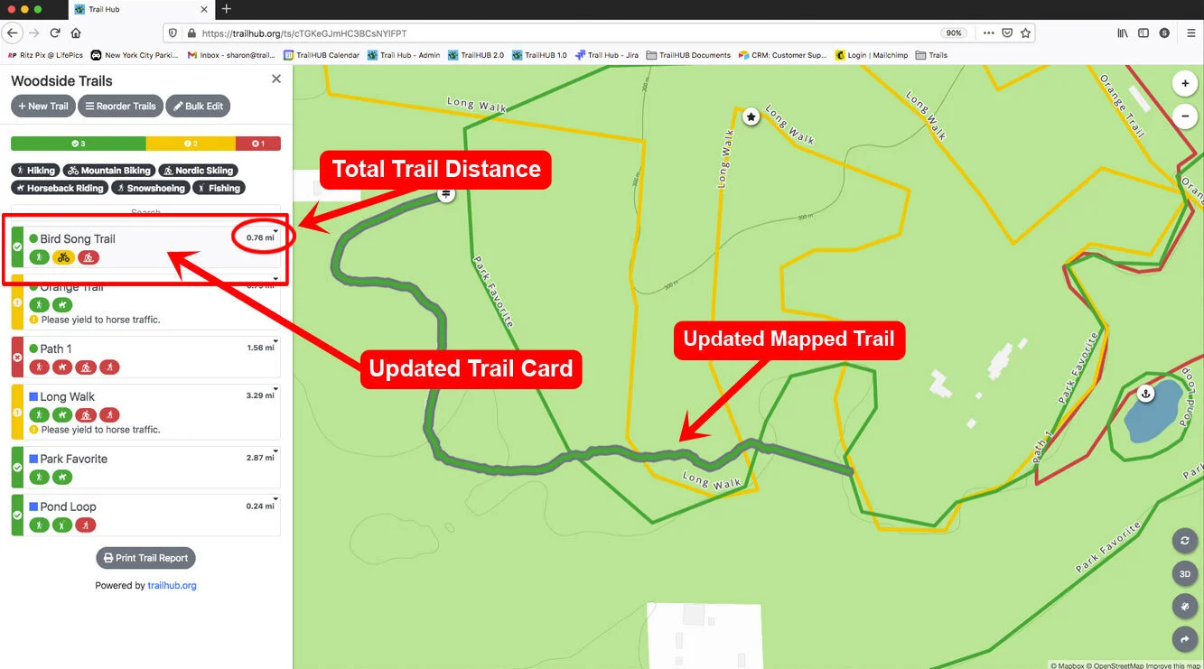
The trail's distance appears in the detail drawer and on the trail card, and an elevation profile is generated shortly after saving.