
Map Guide
A visual tour of the all-trail-systems map, the trail system page, trail cards, and points of interest for public users.
#All trail systems map
Every active trail system in the TrailHUB network appears as a dot on the map at trailhub.org/all. Green means the trail system is open and red means it is closed. The side panel lists the same trail systems and lets you search, filter by activity, or show only My Subscriptions.
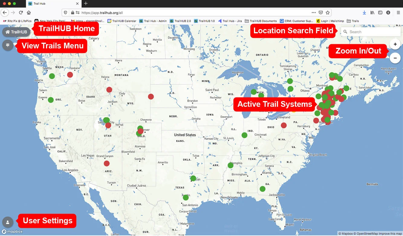
Main page
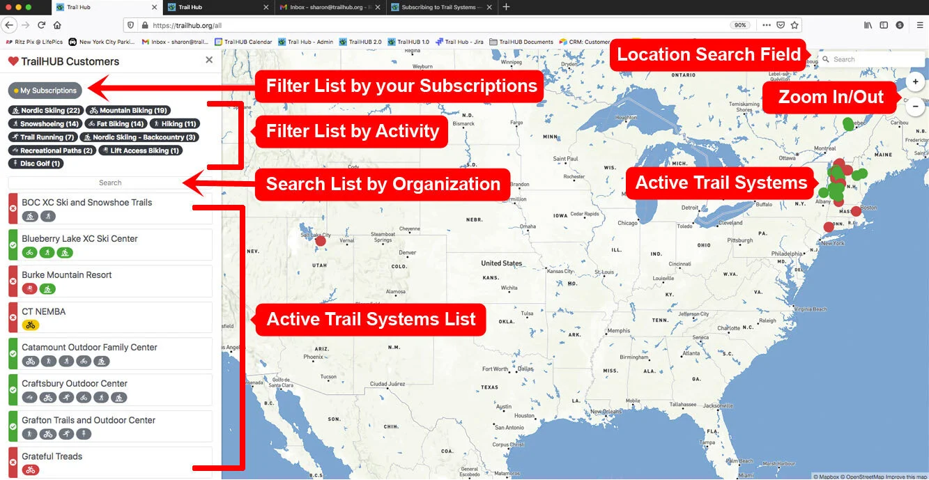
Trail systems panel
#Trail system page
Selecting a trail system opens its own page with the trail map, a trails panel, and the trail system's details.
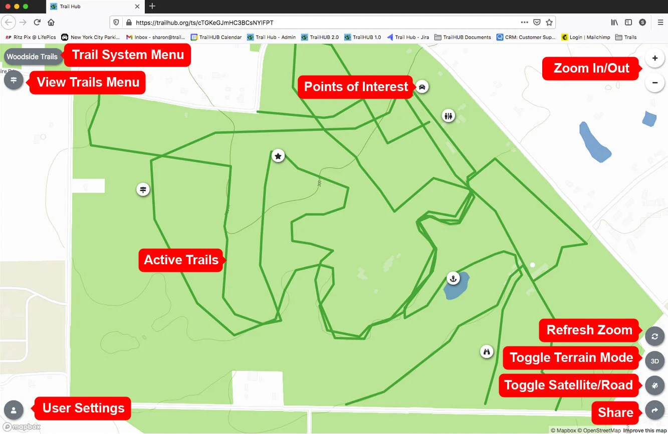
Main trail system page
Points mark notable places around a trail system, such as parking areas, restrooms, trailheads, hazards, scenic viewpoints, restaurants, lodging, lifts, dining menus, and webcams. Select a point on the map to open a panel with its details.
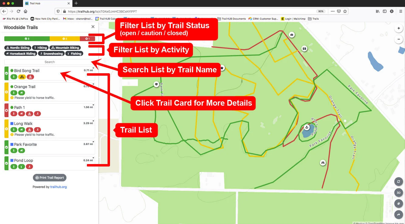
Trails panel
Select a trail card to see its status, difficulty, activities, length, elevation profile, and any current updates attached to it.
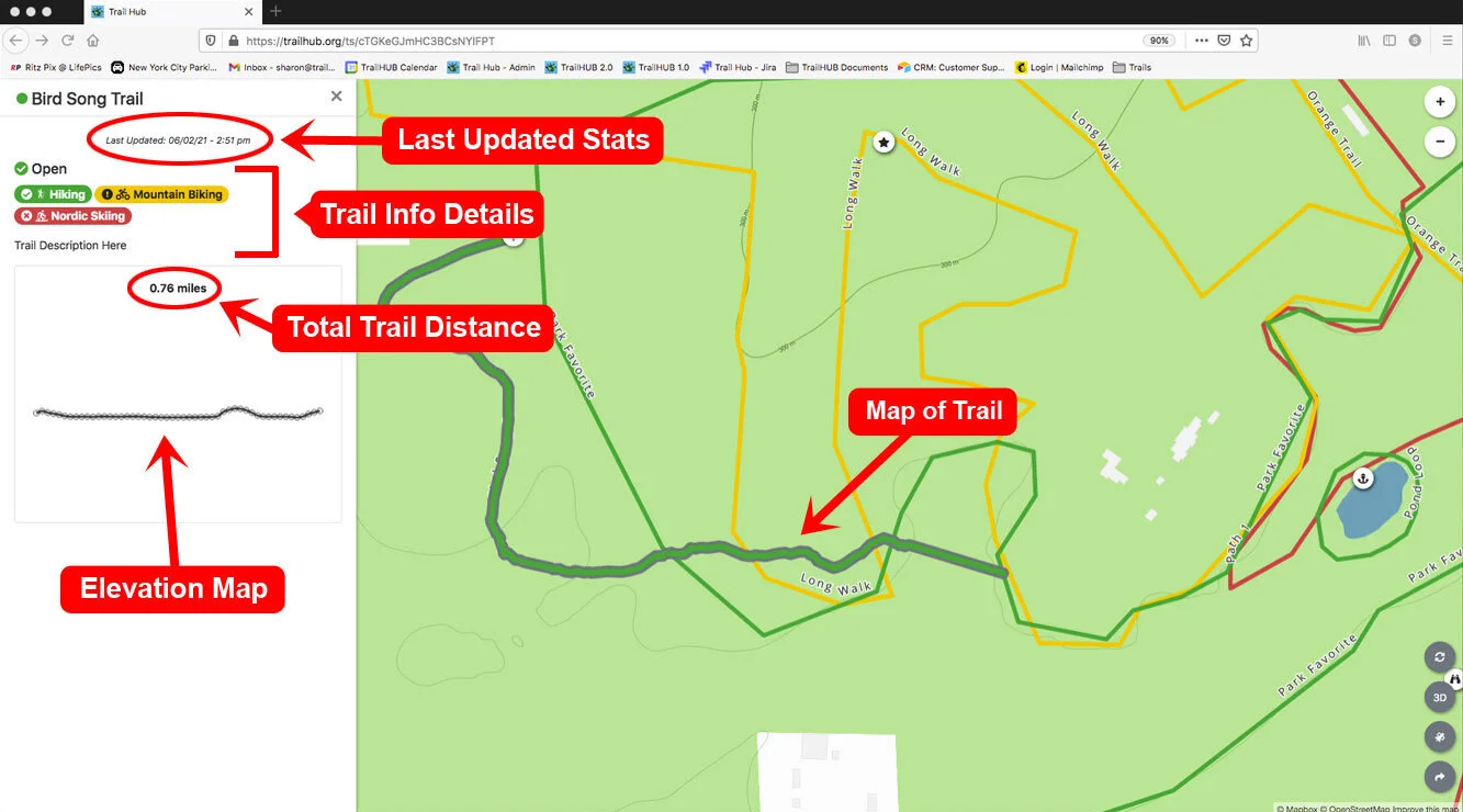
Trail card detail
Select the trail system's name in the upper left to see its description, website, and the Subscribe to Trail Updates button.
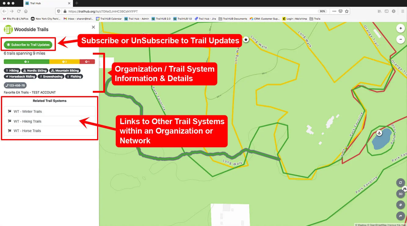
Trail system details
See also map view modes and, for trail managers, the map interface guide.